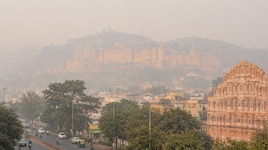
Weather Update: जहरीली हवा के बीच अब चक्रवात की दस्तक, इन राज्यों में बारिश बरपाएगी कहर; आज कैसा रहेगा मौसम?
बंगाल की खाड़ी में बना कम दबाव का क्षेत्र जल्द चक्रवाती तूफान का रूप ले सकता है. इसके चलते ओडिशा-आंध्र प्रदेश में भारी बारिश का अलर्ट जारी किया गया है. पहाड़ों में भी कई इलाकों में बारिश की संभावना है.

Weather Today: देशभर में एकत बार फिर मौसम करवट ले रहा है. भारतीय मौसम विभाग (IMD) के मुताबिक, 15 नवंबर 2026 से पश्चिमी राजस्थान, लद्दाख, हिमाचल प्रदेश और जम्मू-कश्मीर के कई क्षेत्रों में भारी बारिश, तेज हवा और गरज-चमक होने की संभावना है. इसके अलावा बंगाल की खाड़ी में बना कम दबाव का क्षेत्र भी तेजी से मजबूत होता दिख रहा है. यह 16 नवंबर 2026 की शाम चक्रवाती तूफान में बदल सकता है.
इस चक्रवाती तूफान के चलते 18-19 नवंबर 2026 तक तटीय आंध्र प्रदेश और ओडिशा में भारी बारिश होने की संभावना है. भारी बारिश की संभावना के देखते हुए मछुआरों को भी समुद्र किनारे न जाने की सलाह दी गई है.
यहां बारिश बिगाड़ेगा मौसम
IMD के अनुसार, बंगाल की खाड़ी में बना कम दबाव का क्षेत्र लगातार मजबूत हो रहा है, जो आज ( 15 नवंबर2 2026) को डिप्रेशन में बदल सकता है. इसके बाद यह उत्तर-पश्चिम दिशा में आगे बढ़ सकता है. इस वेदर सिस्टम के 16 नवंबर 2026 की शाम चक्रवाती तूफान में बदलने की संभावना है.
मौसम संबंधी चेतावनी ! मुख्य बिंदु: (i) दक्षिण-पूर्वी बंगाल की खाड़ी के ऊपर बना सुस्पष्ट निम्न दबाव का क्षेत्र (Well Marked Low Pressure Area) अगले 24 घंटों के दौरान उत्तर-पश्चिम दिशा में आगे बढ़ते हुए उसी क्षेत्र में अवदाब (Depression) में intensify होने की बहुत अधिक संभावना है। इसके बाद, इसके उत्तर-उत्तर-पश्चिम दिशा में आगे बढ़ने तथा 16 नवंबर की शाम तक दक्षिणी और उससे सटे पश्चिम-मध्य बंगाल की खाड़ी के मध्य भागों में चक्रवाती तूफान (Cyclonic Storm) में और अधिक तीव्र होने की संभावना है। (ii) पश्चिमी विक्षोभ (Western Disturbance) के प्रभाव से 14 एवं 15 नवंबर, 2026 को पश्चिमी हिमालयी क्षेत्र में हल्की से मध्यम वर्षा/बर्फबारी तथा उत्तर-पश्चिम भारत के मैदानी इलाकों में हल्की वर्षा होने की संभावना है। Highlights (i) A Well Marked Low-Pressure Area formed over Southeast Bay of Bengal. It is very likely to move northwestwards and intensify into a depression over the same region during next 24 Hours. Thereafter, it is likely to move north-northwestwards and intensify further into a cyclonic storm over the central parts of south and adjoining westcentral Bay of Bengal around 16th November evening. (ii) A Western Disturbance is likely to cause light/moderate rainfall/snowfall over Western Himalayan Region and light rainfall over plains of Northwest India on 14th & 15th November, 2026. Northwest India: ❖ Isolated to Scattered rainfall likely over Himachal Pradesh, Jammu-Kashmir-Ladakh-Gilgit-BaltistanMuzaffarabad and Uttarakhand during 14th-15th November. ❖ Isolated rainfall likely over Haryana Chandigarh & Delhi and Punjab on 14th & 15th November; West Rajasthan and West Uttar Pradesh during 14th-15th November; East Rajasthan on 15th November. ❖ Isolated thunderstorm, lightning & gusty winds (speed reaching 40-50 kmph gusting to 60 kmph) likely over Jammu-Kashmir-Ladakh-Gilgit-Baltistan-Muzaffarabad on 14th November, with gusty winds (speed reaching 30-40 kmph gusting to 50 kmph) likely over Uttarakhand on 15th November. ❖ Isolated thunderstorm, lightning & gusty winds (speed reaching 30-40 kmph gusting to 50 kmph) likely over East Rajasthan and West Rajasthan on 15th November. East India: ❖ Fairly Widespread to Widespread rainfall likely over Andaman & Nicobar Islands during 14th-20th November; Odisha during 19th-20th November. ❖ Isolated to Scattered rainfall likely over Sub-Himalayan West Bengal & Sikkim during 14th-16th November; Gangetic West Bengal during 18th-20th November; Jharkhand during 19th-20th November; Odisha on 18th November. ❖ Isolated thunderstorm, lightning & gusty winds (speed reaching 40-50 kmph gusting to 60 kmph) likely over Andaman & Nicobar Islands during 14th-17th November; Gangetic West Bengal during 19th-20th November; Odisha on 18th November. ❖ Isolated heavy rainfall likely over Andaman & Nicobar Islands during 14th-16th November; Gangetic West Bengal during 19th-20th November; Odisha on 18th November with isolated very heavy rainfall also likely over Odisha during 19th-20th November. ❖ Thundersquall (wind speed reaching 50-60 kmph gusting to 70 kmph) likely over Odisha during 19th20th November. South Peninsular India: ❖ Isolated to Scattered rainfall likely over Kerala & Mahe and Tamil Nadu, Puducherry & Karaikal during 14th20th November; Lakshadweep during 17th-20th November; Rayalaseema, South Interior Karnataka and Telangana during 19th-20th November; Coastal Andhra Pradesh & Yanam during 17th-18th November and on 20th November. ❖ Fairly Widespread to Widespread rainfall likely over Coastal Andhra Pradesh & Yanam on 19th November. Isolated thunderstorm, lightning & gusty winds (speed reaching 40-50 kmph gusting to 60 kmph) likely over Coastal Andhra Pradesh & Yanam on 18th November and on 20th November. Isolated heavy rainfall likely over north Coastal Andhra Pradesh on 18th November and on 20th November with isolated very heavy rainfall also likely over north Coastal Andhra Pradesh on 19th November. Thundersquall (wind speed reaching 50-60 kmph gusting to 70 kmph) likely over Coastal Andhra Pradesh & Yanam on 19th November. West, Central and Northeast India: No significant weather likely over West, Central and Northeast India during the week. Fog warning: Dense fog conditions very likely over East Uttar Pradesh during 16th-17th November; West Uttar Pradesh during 14th-17th November. #IMD #WeatherUpdate #CycloneAlert #BayOfBengal #RainfallAlert #SnowfallAlert #HeavyRainfall #Thunderstorm #DenseFog #FogAlert #WesternDisturbance #WeatherForecast #IMDAlert @moesgoi @airnewsalerts @DDNational @ndmaindia @ICRER_MHA
— India Meteorological Department (@Indiametdept) November 14, 2026
मौसम विभाग ने इस बदलते मौसम को देखते हुए अंडमान-निकोबार द्वीप समूह में भारी बारिश की संभावना जताई है.
Cyclone Alert | Bay of Bengal A Well Marked Low Pressure Area has formed over the Southeast Bay of Bengal and is very likely to intensify into a Depression during the next 24 hours. It is further likely to intensify into a Cyclonic Storm around the evening of 16th November 2026 over the central parts of the South and adjoining Westcentral Bay of Bengal. Fishermen and coastal communities are advised to follow official IMD weather updates and warnings. Stay alert, stay safe! #IMD #CycloneAlert #BayOfBengal #DepressionAlert #CyclonicStorm #WeatherUpdate #IMDAlert #WeatherForecast @moesgoi @airnewsalerts @DDNational @ndmaindia @ICRER_MHA
— India Meteorological Department (@Indiametdept) November 14, 2026
इसके अलावा ओडिशा के केंद्रपाड़ा और जगतसिंहपुर जिलों में 18-19 नवंबर 2026 को बारिश का अलर्ट जारी किया है. दक्षिणी ओडिशा के तटीय इलाकों में भी 17 नवंबर 2026 को भारी बारिश की संभावना है.
दिल्ली में प्रदूषण से हाल बेहाल
IMD के मुताबिक, राजधानी दिल्ली में आज हल्की बारिश देखने को मिल सकती है. इस दौरान अधिकतर इलाकों में सुबह के समय कोहरा रहेगा. राष्ट्रीय राजधानी में आज अधिकतम तापमान 25 डिग्री सेल्सियस और न्यूनतम तापमान 16 डिग्री सेल्सियस तक रहने वाला है.
#WATCH | Delhi: The Air Quality Index (AQI) in the area around Connaught Place is 326, categorised as 'Very Poor', as per the CPCB (Central Pollution Control Board). (Visuals shot at 04:15 am) https://t.co/zFOTwEN8Fd
— ANI (@ANI) November 14, 2026
प्रदूषण की बात करें तो केंद्रीय प्रदूषण नियंत्रण बोर्ड (CPCB) के मुताबिक, दिल्ली में नॉर्थ एवेन्यू के आसपास के इलाके में AQI 329,फिरोजशाह रोड के आसपास के इलाके में AQI 325,कनॉट प्लेस के आसपास के इलाके में 326 और इंडिया गेट के आसपास के इलाके में AQI 323 रहा है. राष्ट्रीय राजधानी में AQI बेहद खराब श्रेणी पर है.
यूपी-बिहार में बिगड़ेगा मौसम?
यूपी बिहार की बात करें तो, उत्तर प्रदेश में 15-17 नवंबर 2026 तक घना कोहरा परेशान कर सकता है. इसके चलते रेल, सड़क और एयर ट्रैफिक प्रभावित होने की आशंका है. यूपी में पश्चिमी इलाकों में घने कोहरे के चलते कई जगहों पर विजिबिलिटी 50 मीटर दर्ज की गई. वहीं, बिहार में फिलहाल इस हफ्ते मौसम में कोई बदलाव होने की संभावना नहीं है.
#WATCH | Delhi: The Air Quality Index (AQI) in the area around India Gate is 323, categorised as 'Very Poor', as per the CPCB (Central Pollution Control Board). (Visuals shot at 04:10 am) https://t.co/sjYmrNlXWN
— ANI (@ANI) November 14, 2026
पहाड़ों में बारिश का अलर्ट
पहाड़ों की बात करें तो, उत्तराखंड में 15 नवंबर 2026 को कई इलाकों में बारिश की संभावना है. इस दौरान 30-40 किलोमीटर प्रकि घंटे की स्पीड से तेज हवा चल सकती है, जो 50 किलोमीटर प्रति घंटे की स्पीड तक पहुंच सकती है. वहीं, हिमाचल प्रदेश में पश्चमी विक्षोभ के चलते 15 नवंबर 2026 को कई इलाकों में बारिश हो सकती है.

About the Author

ट्रेंडिंग
- न्यूज़
- फोटो
- वीडियो